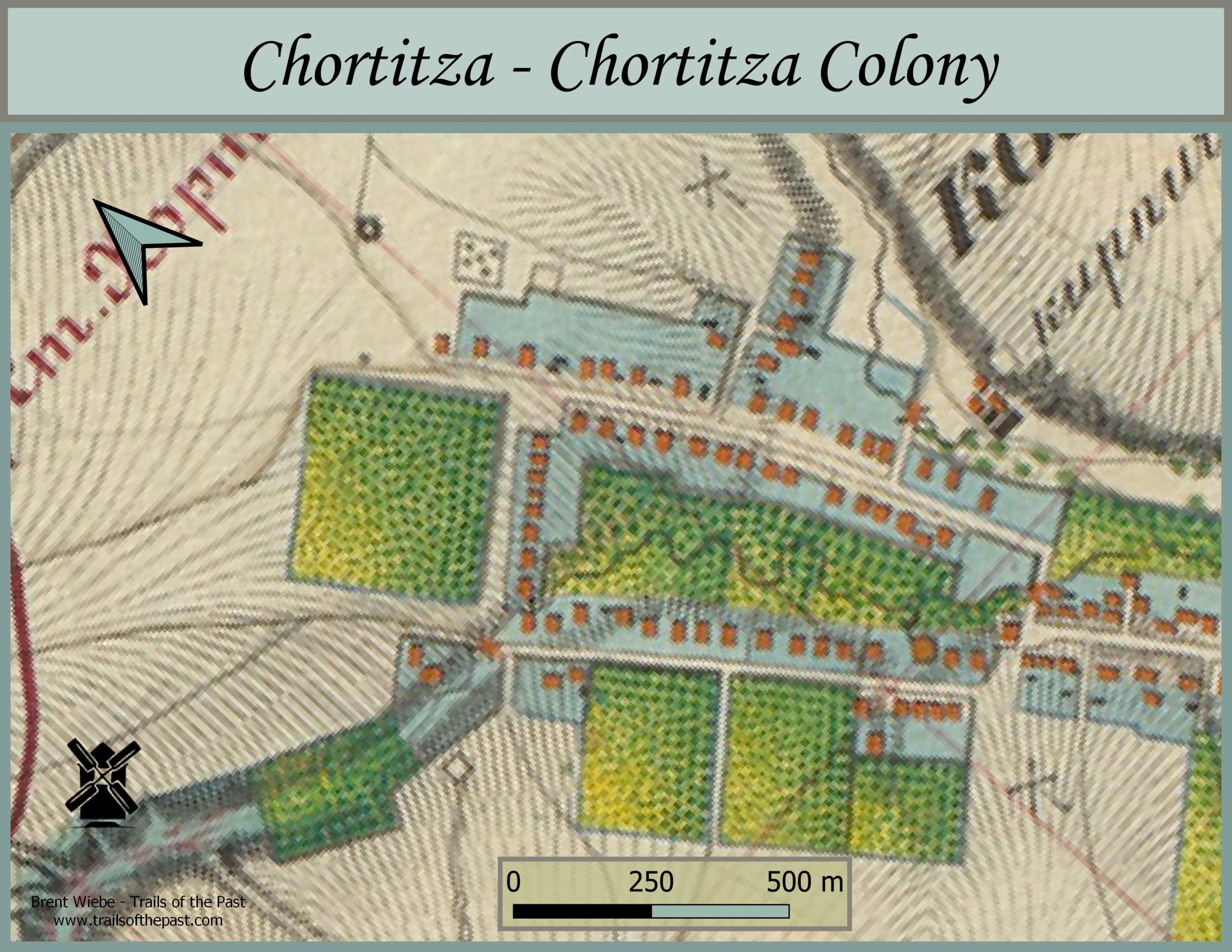
Map of Chortitza with Neighbouring Villages, 1850's
1848 Village Report
(Rough Translation) Chortitz is located in the top of the valley, “upper Chortitza,” from which it derives its name. The village is laid out in an orderly fashion and surrounded by tall mountains, which gives it a pleasant appearance. On the top of the valley stands a small remnant of the oak forest destroyed by the first settlers. They later made up for this destruction by planting orchards. Regular distribution of land was not thought of at that time. Everyone plowed and harvested hay where they wanted, as long as it was very close to the colony. Only some years later was the district surveyed into village and neighbouring boundaries. 34 settlers made up the original total.
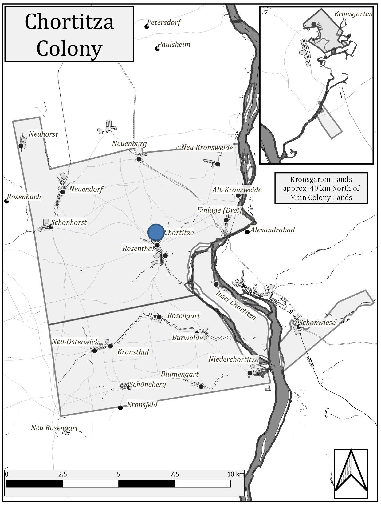
Overview of Chortitza Colony with Chortitza
Sources
Chortiz , 1848 in: M. Woltner, ed., Die Gemeindeberichte von 1848 der deutschen Siedlungen am Schwarzen Meer (Leipzig: Hirzel, 1941), pp. 10. https://chort.square7.ch/kb/woltner.pdf.
The beautifully coloured Russian maps featured here are from the 1850’s. Their purchase was made possible by the generous funding of the Plett Foundation.