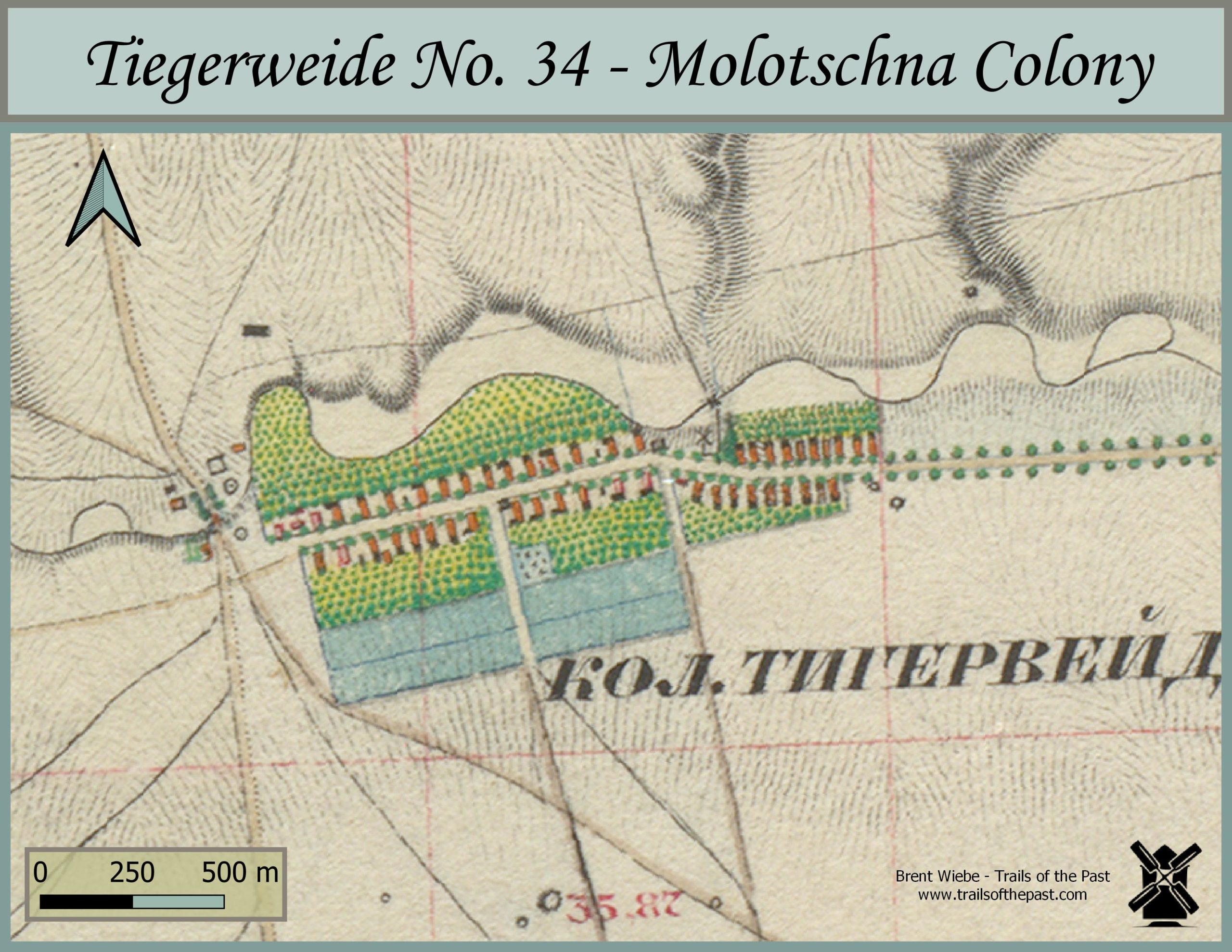
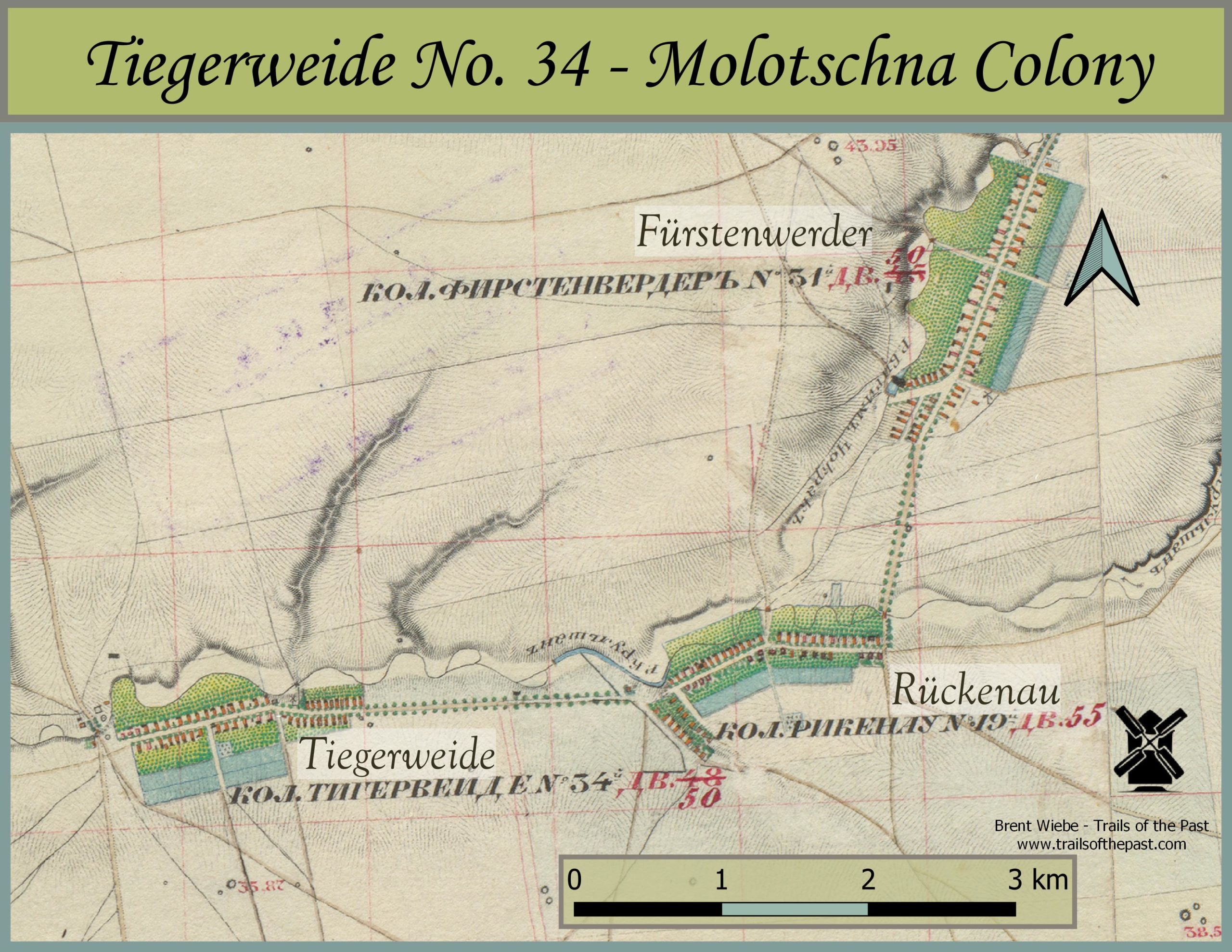
Map of Tiegerweide and Neighbouring Villages, 1850's
Twenty-four Mennonite families founded the village of Tiegerweide in the Molotschna colony in 1822. Ten of these were from other settlements within the colony while the rest were from West Prussia. The families who moved from other Molotschna villages were better off financially than those from West Prussia. Before Tiegerweide was a village, it was grazing land for the sheep from Tiege. By the middle of the century, the approximate time the featured map was made, agriculture in Tiegerweide was considered average. 98, 184 trees beautified the colony, providing shelter, fruit, and wood. Of these, 39,451 were mulberry trees.
94 males and 87 females made up the Tiegerweide population of 181 in 1857. Records show they lived in 49 houses, which approximately matches the featured map.
The beautifully coloured Russian maps featured here are from the 1850’s. Their purchase was made possible by the generous funding of the Plett Foundation.