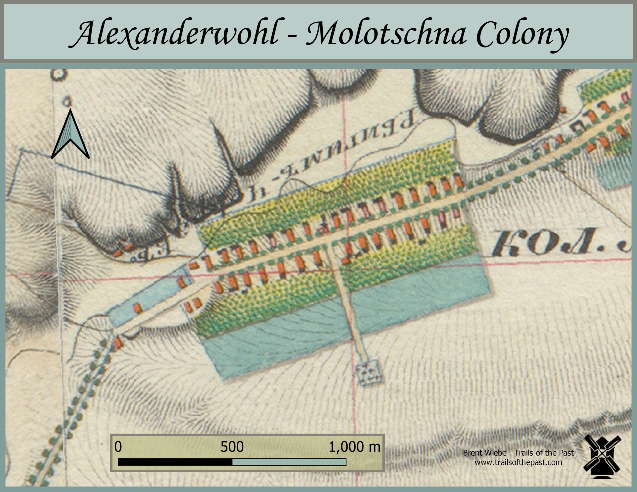
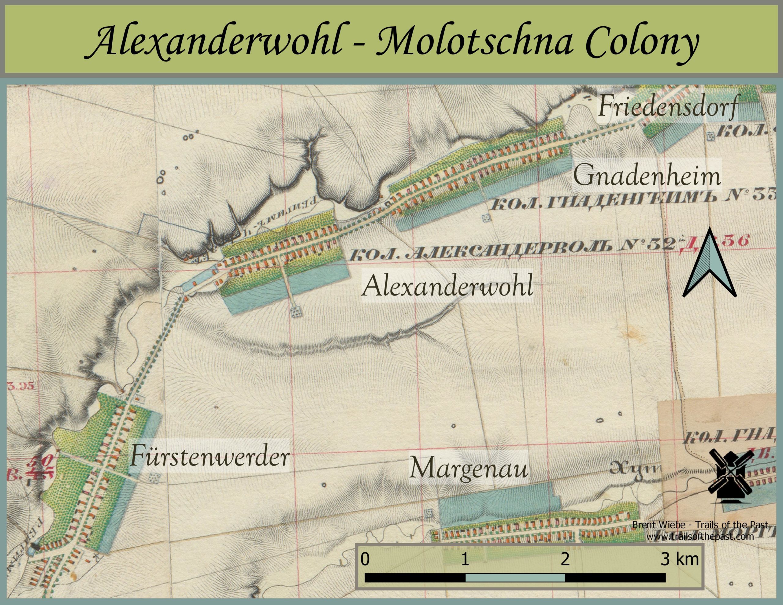
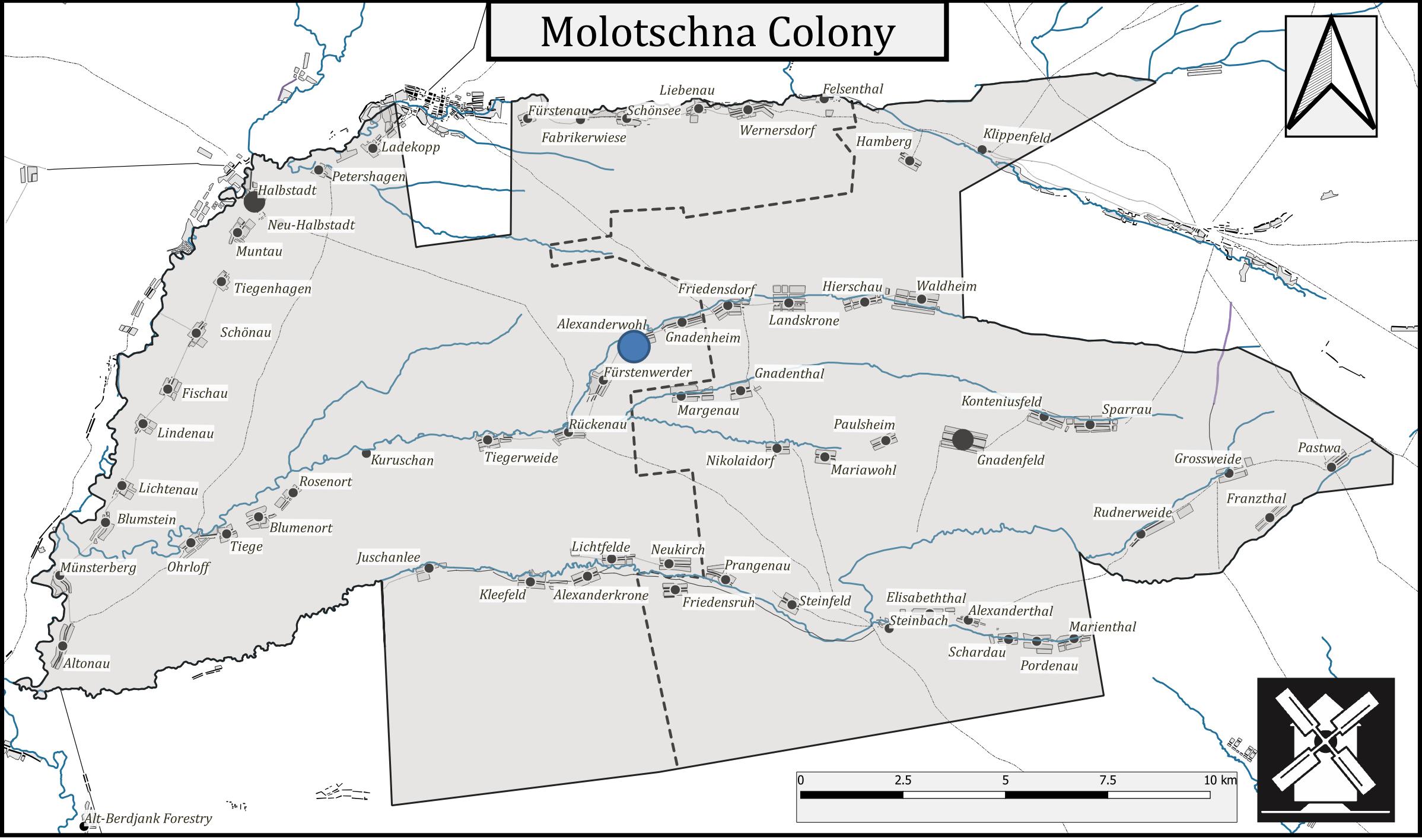
Map of Alexanderwohl and Neighbouring Villages, 1850's
Twenty-two Mennonite families from the Vistula Delta were the initial founders of the Mennonite village of Alexanderwohl in the Molotschna colony in 1821. Their meeting with Czar Alexander I and his well-wishes inspired the name “Alexanderwohl.” Over the next couple of years, more families of the Groningen Old Flemish congregation from the Marienwerder area of West Prussia continued to move in. The first decade was difficult, with meagre crops, grasshoppers, severe storms and cattle disease. This was followed by a drought and famine in 1833. But eventually their hard work paid off and the village became wealthy. They had planted 101,807 trees, including 100 pear trees by 1851.In 1857, within a few years of the date of the map, 191 males and 186 females lived in Alexanderwohl, making a total population of 377 living in 40 houses. This matches the building count on the map and it would be interesting to match the Wirtschafts with their owner’s names.
The beautifully coloured Russian maps featured here are from the 1850’s. Their purchase was made possible by the generous funding of the Plett Foundation.